글, 사진: Peter Kim
2008년 4월 Khumbu (Gokyo - Cho La Pass - Kala Patthar-Dingboche) 지역을 다녀온 이후
저는 그곳에 가야만 치유가 되는 히말라야 병에 중독되어 매일 임자체 등정을 가슴에 안고 생활하였으나,
집사람이 "임자체 등정은 위험하여 절대로 허락해 줄수 없다" 고 하여 가슴알이만 하던중 작년 겨울
서울에서 LA로 돌아오는길에 인천공항에서 저히 부부가 김명준님을 우연히 뵙게되었는데 그때 집사람에게
잘 말씀해 주신 덕분에 지난달에 다녀올수 있었습니다.
조금은 무리한 일정이었지만 다행히도 14일 동안 최고의 포터 그리고 좋은 날씨 및 훌륭한 등정 가이드 덕분에
계획하였던 임자체 등정및 쿰부 3패스 (Kongma La, Cho La & Renjo La) 를 무사히 마칠수 있었습니다.
Namche 및 Dingboche 에서 하루씩 고소를 적응할 시간적 여유가 없었기에, Lukla 에서 Chhukhung 까지 가는 동안에는
여유를 갇고 무조건 천천히 걸으며 고소를 적응하면서 산행을 하였습니다.
간단하게나 저의 임자체 등정 이야기를 나누고자 합니다.
임자체 등정은 저 혼자 시도하였습니다. 물론 Kathmandu 에 있는 Imja Tse Expedition을 전문으로 하는 agency 에게 등정에 필요한 모든 수속 (Permit, Climbing Guide, 등등) 을 의뢰하였고 많은 도움을 받아 진행하였습니다.
Peter Kim
3/25: Seoul - Kathmandu
3/26: Kathmandu - Lukla (by air) - Monjo (9,300 ft)
3/27: Monjo - Namche Bazar (11,286 ft) - Syangboche (12,664 ft) - Namche Bazar (11,286 ft)
3/28: Namche Bazar - Deboche (12,532 ft) - Snowed all day
3/29: Deboche - Dingboche (14,468 ft)
3/30: Dingboche - Chhukhung (15,518 ft)
3/31: Chhukhung - Chhukhung Ri (18,208 ft) - Chhukhung - Rest and acclimation day
4/01: Chhukhung - Imja Tse Base camp (16,666 ft)
4/02: Imja Tse (20,305 ft) Summit - Base camp - Chhukhung - longest day of my life!
4/03: Chhukhung - Kongma La Pass (18,159 ft) - Lobuche (16,108ft)
4/04: Lobuche - Gorak Shep (16,863 ft) - Kala Patthar (18,208 ft) - Lobuche - Snowed all day
4/05: Lobuche - Dzonglha (15,846 ft) - Cho La Pass (17,486 ft) - Drangnag (15,419 ft) - Gokyo (15,551 ft) - snowed overnight
4/06: Gokyo - Gokyo Ri (17,585 ft) - Gokyo - Renjo La Pass (15,551 ft) - Marulung (13,812 ft)
4/07: Marulung - Thame (12,467 ft) - Thamo (11,460 ft) - Namche Bazar
4/08: Namche Bazar - Lukla
4/09: Lukla - Kathmandu
4/10 ~ 4/20: Seoul, Korea (Business)
On April 1, after a three hours walking down the Lhotse wall, We (Climbing Guide, Porter, cook and I) reached the Imia Tse Base camp.
As we arrived early at base camp, we discussed the option of going up directly to high camp. Located at 5500 meters, it was just another couple of hours up a rocky wall, almost visible from the base camp itself. However, at around 2 pm the, the first afternoon clouds were already reaching the camp, making it almost impossible to reach the high camp on time to put the tents before the big winds and coming night.
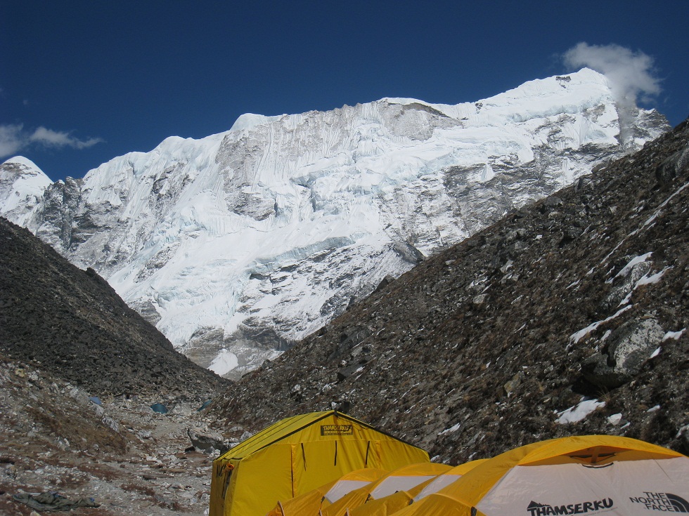
We then decided to walk up the highest part of BC and established camp. Seeing that the high camp was only 2 hours up, we rapidly discussed the possibility of making a summit bid in one day from the base camp. My health and spirit were real good, so I decided to go for it. After a good dinner at 5, we closed the tent and attempt sleeping at around 6pm with our alarm clock set up for midnight.
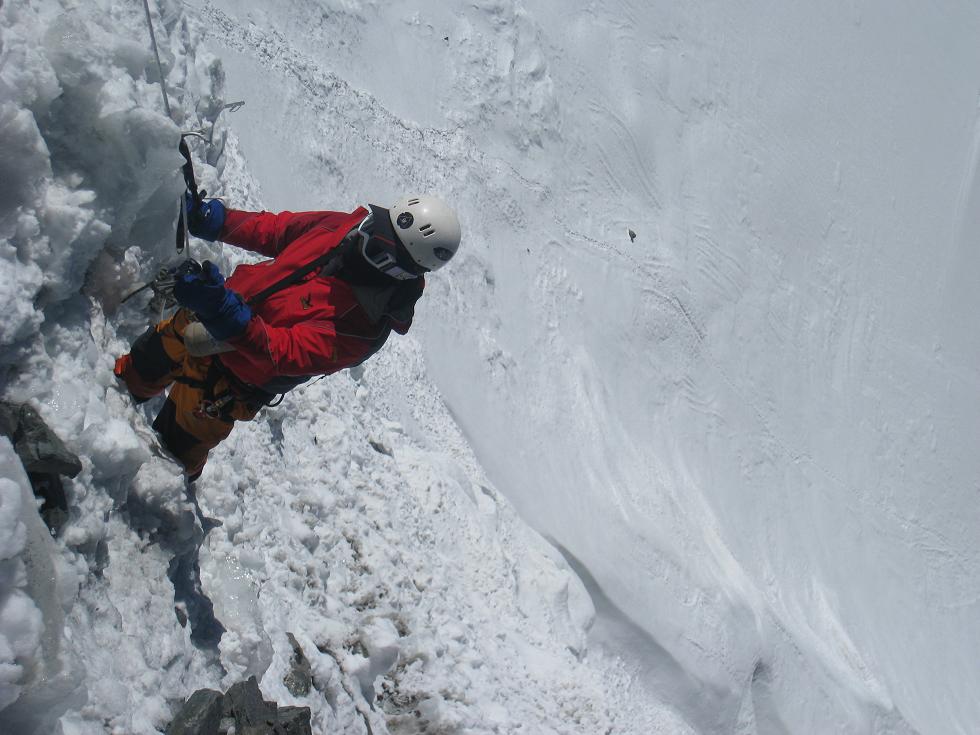
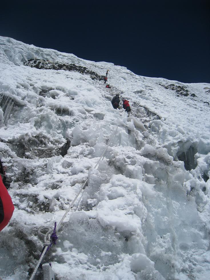
On April 2, after a quick breakfast, we started walking around 2am. In complete darkness, another team of Italian climbers in front of us. After a few hundred meters of walking, we reached the bottom of the rock wall leading to high camp. We climbed in a slow but steady rhythm and rapidly passed the Italian team as they keep making pauses. The rocky climb was in itself really boring and long. About 4 hours of climbing through big rocks sometimes walking on narrow and steep rock bridges not having any idea of what was below. Which was actually better since when coming down, we realized how steep the climb actually was.
We arrived at first snow around 6 am, at sunrise. (View of Ama Dablam and Imja Lake)
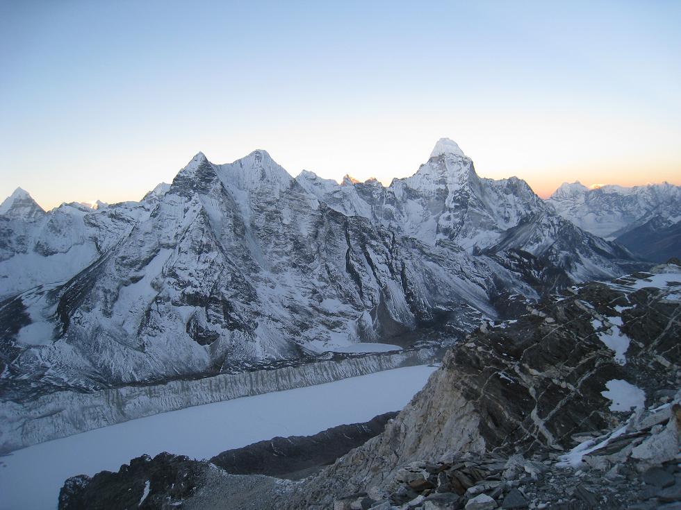
By the time we put on the harness and our crampons, it was almost complete day light, which made the second part of the climb much nicer and warmer.
My speed got slowed considerably since we were already at 5800 meters walking in deep snow.
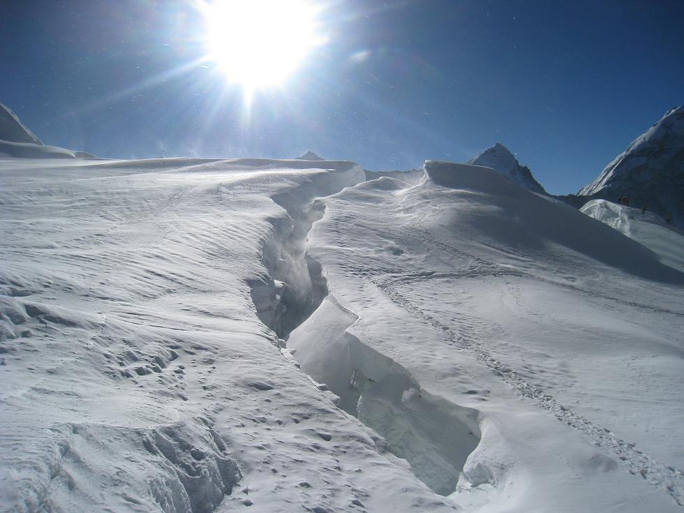
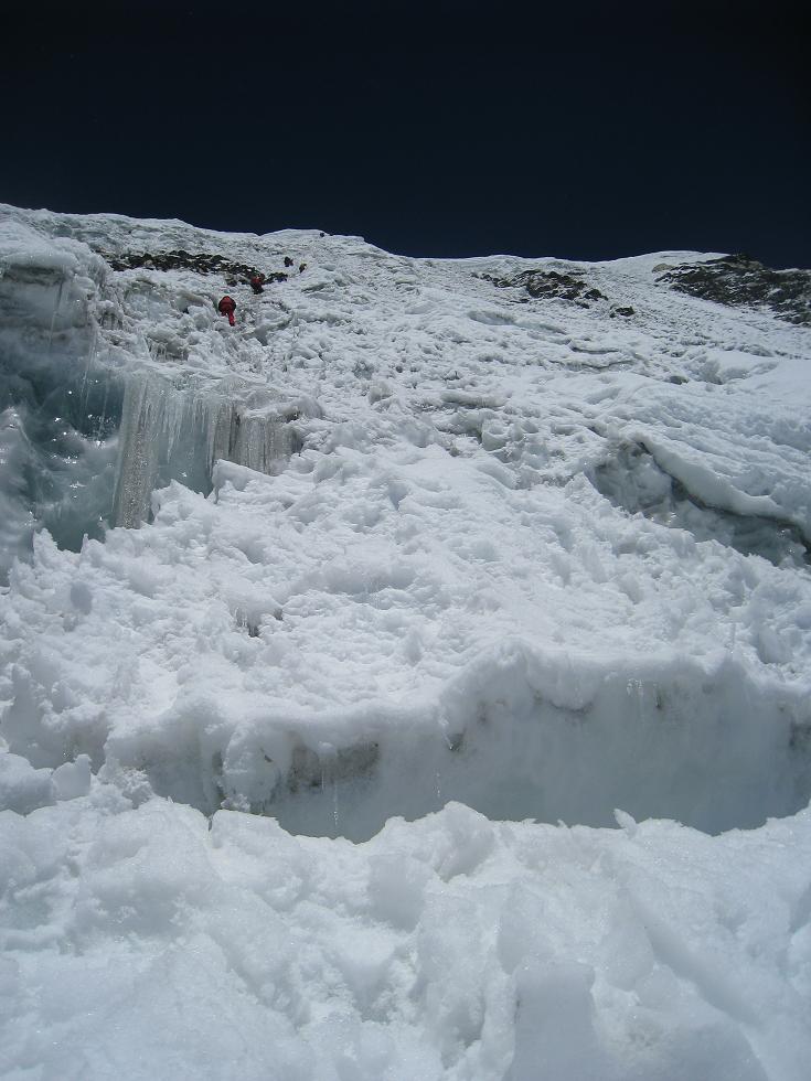
The first couple of hours were a succession of flats and slopes across the crevasses. It was impossible to make a straight line towards the summit wall, the crevasses were a few meters wide and 50 to 100 meters deep.
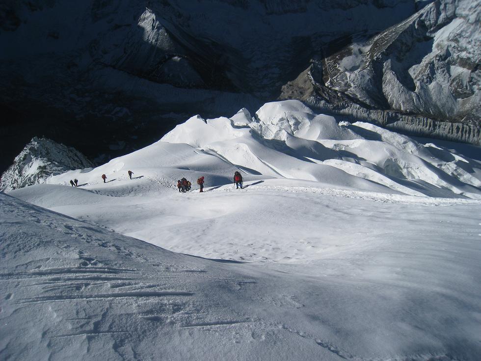
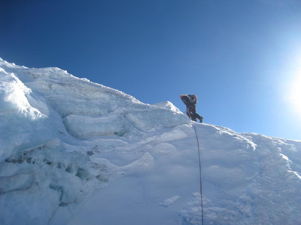
The summit wall was probably the hardest thing I have done in my life. Going up 100 meters in altitude on a 65 degree wall above 6000 meters.
This time all our equipment had to be used. I had first to give up on my digital (point and shoot) camera and put it back in my backpack.
On my right hand, my ascender going up the rope and securing the safety hooks, on the left, the ice axe, only took to actually ascend the wall other than my legs.
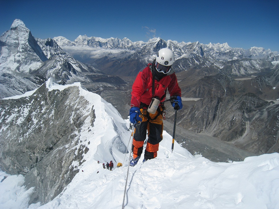
The wall ascent lasted for about three hours. When I reached the summit ridge, my throat was so dry that the first thing I did was reaching to for my water trying to drink everything that has not become ice.
Reaching the summit ridge seemed as an accomplishment, but the summit was still ahead. The ridge continued in quite a sharp ascent of 50 meters in altitude. I personally was very tired, but the optimism of my climbing guide pushed me towards the last 40 minutes. The summit itself was really small. 6 people would barely fit on top of it.
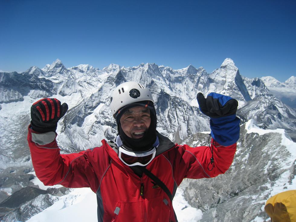
When we arrived, we were of course overwhelmed with this sense of success, but I also knew we had little time before starting the descent. So I took snapshots of everything around me.
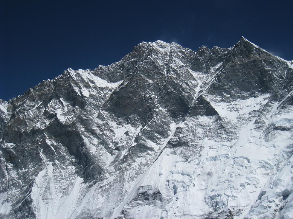
(Lhotse South view from Imja Tse Summit)
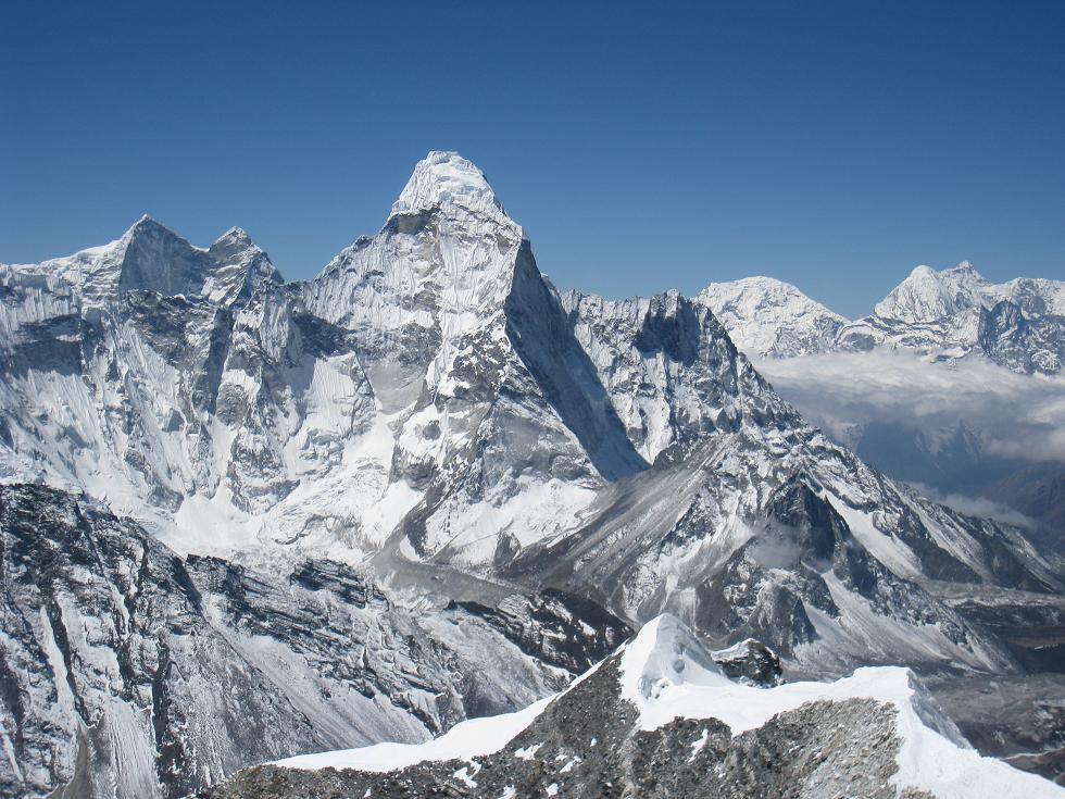
(Ama Dablam view from Imja Tse)
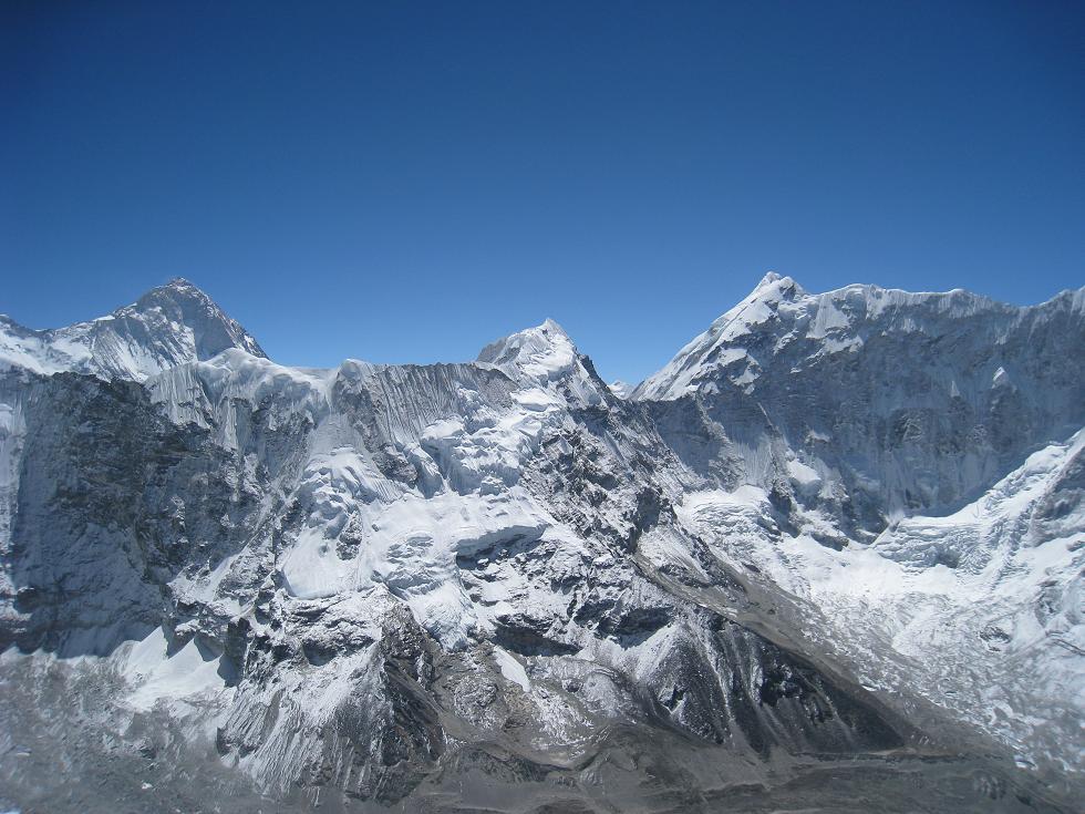
(Makalu - left and Baruntse - right)
As we begin the descent, clouds were slowly covering the summit – seems like we just reached it on time.
The descent was very long, in particular in the rocky parts, which was much more scary than during the ascent. After a small break at base camp, we continued directly back to Chhukhung where we arrived around 8pm… 18 hours of walking and climbing… the longest day!
Goodbye Imja Tse, Hello Everest!
 히말라야 K2 - 발토르 빙하 등정기<1>
 에쿠아도르 침보라조 등반기